WeatherOptics empowers emergency managers with precise, predictive weather insights seamlessly embedded into the Juvare platform. This integration enhances situational awareness by combining WeatherOptics’s forward-looking impact forecasts with Juvare’soperational workflows, enabling proactive decision-making and optimized resource allocation.
Scott Pecoriello
CEO, WeatherOptics
Integrated Weather Intelligence for Operational Readiness
By integrating WeatherOptics’ advanced weather insights with Juvare’s WebEOC platform, logistics leaders now have the tools to proactively identify and minimize these risks. Using our weather-adjusted ETA predictions and impact risk scores, companies can enhance safety, efficiency, and reliability across their supply chain.
Industry leaders are already leveraging the power of WeatherOptics through WebEOC to pinpoint and avoid adverse weather impacts, ensuring operational continuity for drivers, customers, and logistics networks.
Case Study
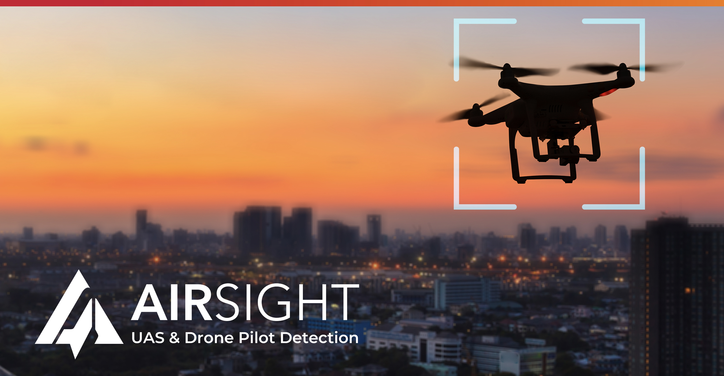
Real-World Impact: Event Security at Scale
Learn how WebEOC played a critical role in enhancing safety and situational awareness at a major stadium during high-profile events like the NFL Pro Bowl. Working in tandem with AirSight’s drone detection technology, WebEOC helped coordinate real-time responses to emerging threats.
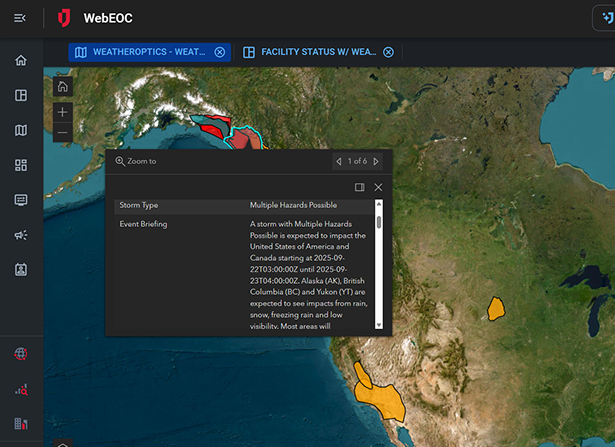
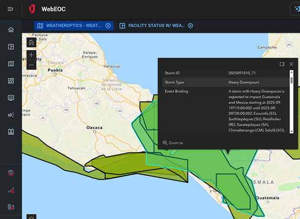
WeatherOptics data and insights flow into WebEOCand UCP through Juvare Connectors, giving users instant access to advanced weather intelligence.
Predictive Analytics
Machine learning models combine geospatial, historical, and operational data to forecast the impact of weather on facilities and resources.
Automated Alerts
Configurable notifications inform key stakeholders when risk thresholds are met or exceeded.
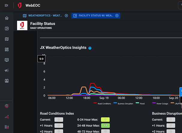
Impact Indices
Proprietary indices measure risks such as flooding, power outages, road hazards, and operational disruptions to support proactive decision-making.
Frequently Asked Questions
How does the WeatherOptics integration assist during critical weather events?
The WeatherOptics integration brings real-time, impact-based weather intelligence directly into WebEOC and UCP, allowing users to see severe weather threats—like flooding, high winds, or storms—alongside their incident data, improving situational awareness and response speed.
What unique capabilities does WeatherOptics provide?
WeatherOptics stands out for its impact-first forecasting, including customized risk scores, hyperlocal threat assessments, and proprietary indices (like Power Outage Risk or Road Hazard Levels). Within WebEOC and UCP, users can overlay these insights on custom maps or dashboards, helping them preposition resources, issue timely alerts, and make proactive decisions tailored to the actual risks faced by their jurisdiction.
How is WeatherOptics different from traditional weather data?
WeatherOptics focuses on operational impact rather than raw weather metrics, helping managers understand what the forecast means for operations. In other words, instead of “25 mph winds,” users will see “moderate risk of power outages” or “high risk of icy roads.” It’s built to help emergency managers understand what the weather means for operations.
How does it support long-term planning and resilience?
The integration documents weather impacts and responses, supporting planning, after-action reviews, and future readiness.
How can organizations get started?
To get started, identify your biggest weather pain points (e.g., road conditions, storm surge, or power outages) and tailor your WebEOC and UCP boards to show the WeatherOptics layers that matter most to you. From there, train your team on how to use those insights in real-time, and plug them into your SOPs. Both Juvare and WeatherOptics are happy to help with setup and training.
We Recommend Setting Up Physical Hardware
To get the most out of AirSight’s drone detection, Juvare partners with AirSight to install physical hardware at your location. This includes RF sensors, radar units, and antennas that work together to detect drone signals and pinpoint exactly where the operator is located.