Josh Nolan, Product Manager, WebEOC/GIS at Juvare

Today is GIS Day, an international celebration recognizing how the real-world applications of GIS technology are making a difference in our society.
You might ask: What is GIS? What do Situational Awareness and GIS have in common?
Put simply, they have everything in common! They fit together perfectly, like driving with the top down in a convertible as you cruise along the edge of a beach taking in the salt air and warm breeze.
Geographic Information Systems (GIS) by its very nature provides new insights into data and depicts relationships that tables can’t show, giving you a clear understanding of where everything is.
Remember that saying, a picture is worth a thousand words? In this case, that is the absolute truth.
You may be thinking, thanks for the elevator pitch but I’ve been making decisions just fine for years. I don’t think I need this GIS stuff now.
If that’s the case, let me ask you a few questions:
- How can you understand a situation if you can’t see it and what is around it?
- How do you know the ambulance you just dispatched is really the closest one?
- How do you know you just selected the best evacuation route to clear everyone out of an area?
Probably at least one of those questions caused you to pause for a moment or stirred up some anxiety as you wrestled with an answer. This is exactly where GIS comes in, to provide you with more information so you can make the best possible decision in the moment.
GIS technology is used to show you where everything is and can perform analytics to help guide you to make great decisions.
Here’s a hypothetical scenario that illustrates exactly where GIS fits in:
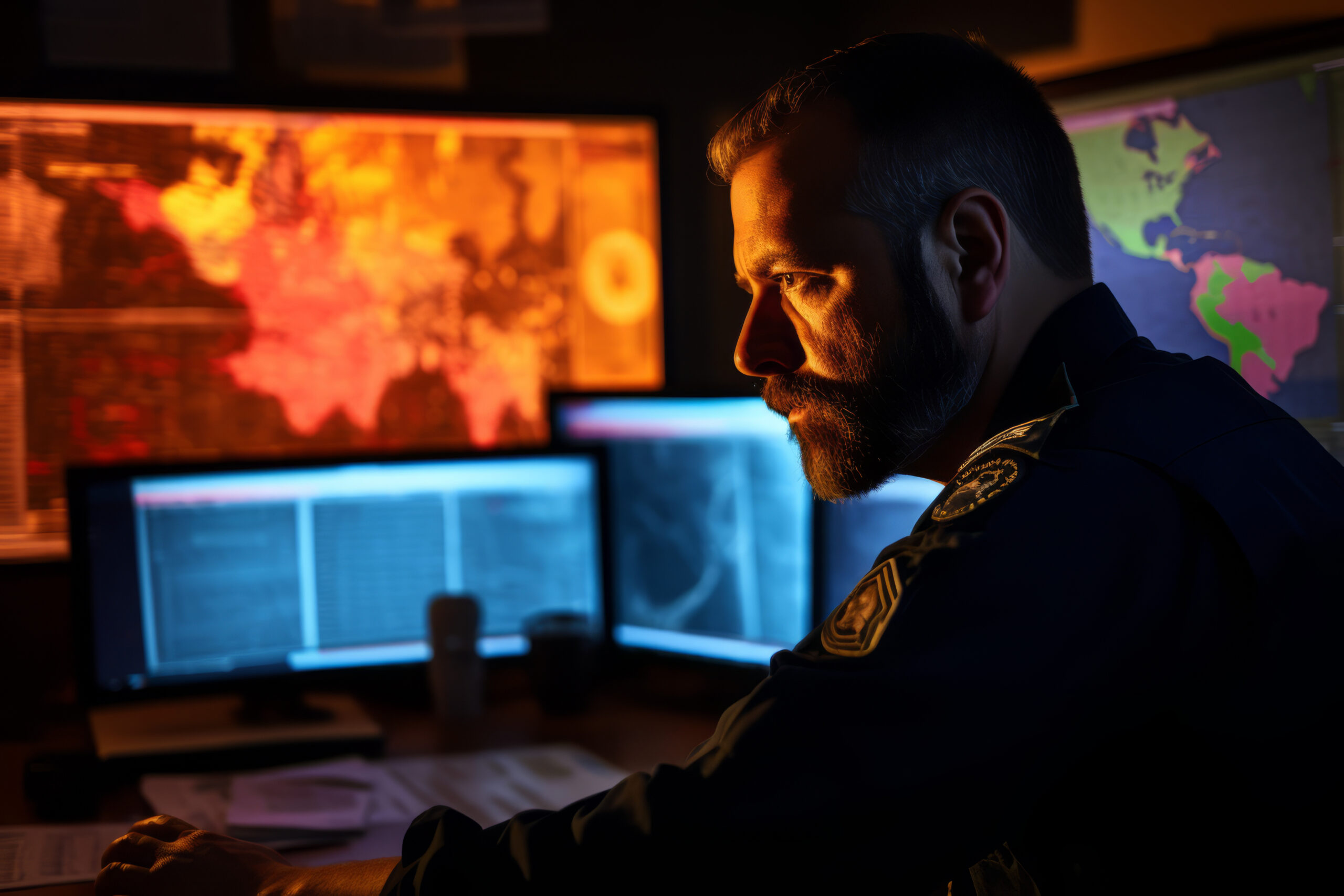
A wildfire is raging, claiming hundreds of acres every day, and you are trying to figure out how to stop it from spreading or determine who might be affected by it. GIS can help.
You can run simulations using live feeds to help determine where the fire might spread and where evacuations might be necessary, as well as where the smoke is drifting and may cause poor air quality.
Now that you have an idea of where it is going and who is affected, you can develop your plan and staff it accordingly. Also, if things take a turn for the worse or if you are short on resources to execute the plan, you can use GIS to locate additional resources and figure out which ones can get on scene fastest.
With the wildfire over you’ll probably feel a lot more confident in your decisions and the after-action report will likely show that the situation was handled to the best of everyone’s abilities.
While GIS can be used to handle a very large event, just like in this scenario, it works just as well to handle the daily tasks to ensure your jurisdiction is operating efficiently and safely.
GIS is the foundation to true Situational Awareness – giving you insight into some things you may have never seen before.
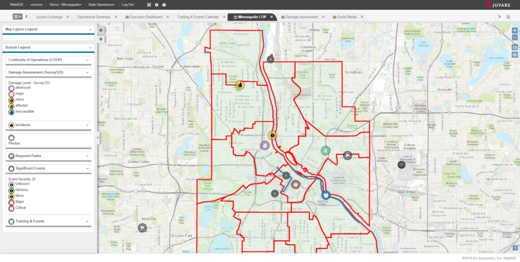
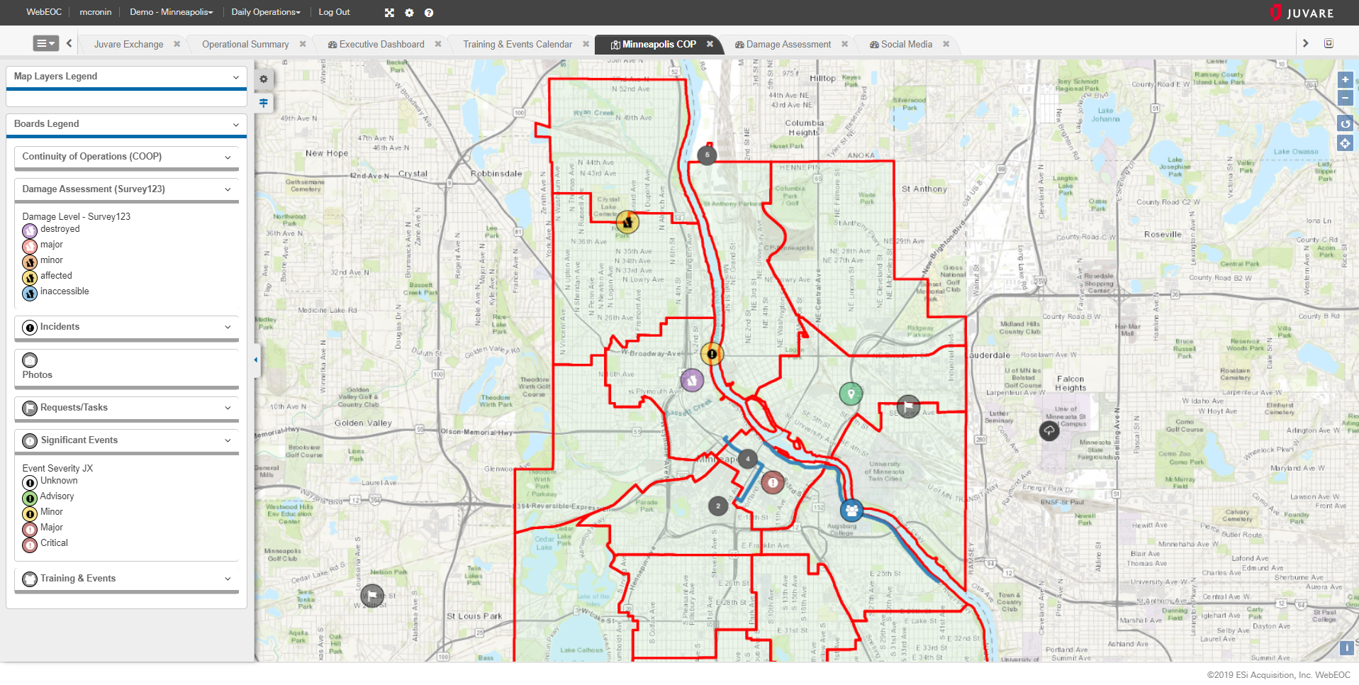
Juvare’s WebEOC and Juvare Exchange both utilize GIS to help provide more insightful information and integrate with other GIS systems to leverage existing datasets and analysis tools.
Are you using GIS to serve your jurisdiction? If not, there is no better time to start than today – on GIS Day 2019.