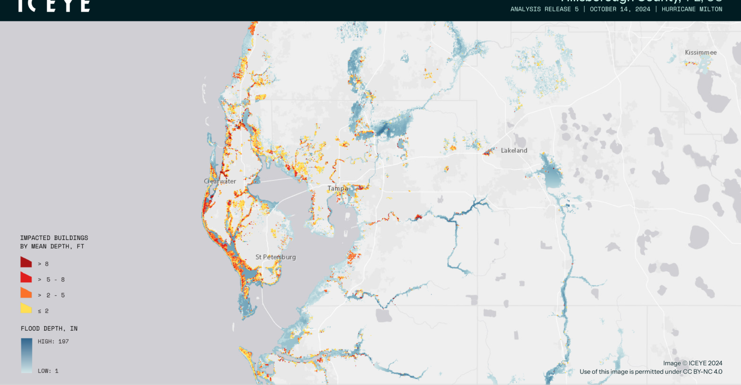
WebEOC now delivers structure-level flood depth and extent data directly to emergency managers, giving response teams critical visibility into which areas were hardest hit and where to deploy resources first. Powered by ICEYE’s near real-time SAR observations, this integration operationalizes live flood intelligence within WebEOC for faster, more coordinated decision-making across the full response lifecycle.
Join Juvare and ICEYE, alongside the South Florida Water Management District, the Florida Division of Emergency Management, and Lee County, Florida to hear how WebEOC’s operational coordination — enhanced with SAR-derived flood insights — is driving response and recovery decisions during major hurricane events.
Join us:
- August 5, 2026
- 1:00pm Eastern Time (US & Canada)
- Live on Zoom
Speakers:
- John Schultz, Chief, Emergency Management Department of Public Safety, Lee County
- Ana Carolina Coelho Maran, Chief of District Resiliency, Division Director, Flood Control and Water Supply Planning, South Florida Water Management District
- Daniel Rydl, GIS Administrator, Information & Technology Management Bureau, Florida Division of Emergency Management
- Mike Bennett, Head of Government Solutions, North America, ICEYE
- Gretchen Chiques, Senior Solutions Engineer, ICEYE
- Matt Cronin, VP of Solutions Engineering, Juvare
Who should attend?
- Emergency Managers
- EOC Directors and Staff
- GIS and Geospatial Professionals
- Floodplain and Water Management Officials
- Public Safety Leaders (Fire, Law Enforcement, EMS)
- Public Works and Infrastructure Managers
- State and Local Government Officials
- Disaster Response and Recovery Coordinators
- Critical Infrastructure and Utility Operators
- WebEOC Users and Emergency Management Technology Leaders
You’ll learn…
- How near real-time SAR flood intelligence enhances situational awareness during hurricane response.
- How structure-level flood depth and extent data helps prioritize resource deployment and damage assessment.
- How ICEYE flood insights integrate with Juvare WebEOC to support faster, more coordinated decision-making.
- Best practices and lessons learned from real-world deployments by emergency management leaders in Florida.
- How geospatial intelligence can improve response and recovery operations before, during, and after major flood events.
Why it matters…
- Gain faster, more accurate situational awareness during flood and hurricane events.
- Prioritize response efforts using near real-time, structure-level flood intelligence.
- Improve coordination across agencies with a common operational picture in WebEOC.
- Make more informed decisions that can reduce response times and improve community outcomes.
- Learn proven strategies from agencies that have successfully used these capabilities during major hurricane events.