ICEYE’s all-weather satellite imagery provides rapid, precise data on floods, fires, and structural impacts, improving decision-making in real time. Automated alerts and insights on event severity empower responders to prioritize resources and act quickly, even in difficult conditions. This streamlined, global coverage delivers actionable intelligence directly to Juvare users, enhancing emergency response and resilience across sectors.
Andy Read
Global Head of Government, ICEYE
Seamless WebEOC Integration for
ICEYE, with the world’s largest SAR satellite constellation which offers uninterrupted visibility on the ground, in all conditions, provides near real-time insights into natural disasters at the community level. This unparalleled situational awareness empowers government agencies to lead timely disaster response and recovery efforts, and enhance local resilience.
Case Study
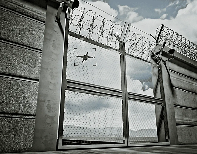
Real-World Impact: Event Security at Scale
Learn how WebEOC played a critical role in enhancing safety and situational awareness at a major stadium during high-profile events like the NFL Pro Bowl. Working in tandem with AirSight’s drone detection technology, WebEOC helped coordinate real-time responses to emerging threats.
ICEYE’s synthetic aperture radar (SAR) satellites provide near real-time visibility, even in low visibility conditions.
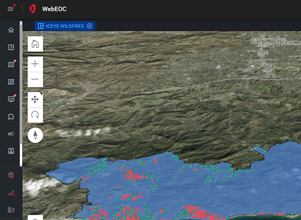
Rapid Disaster Assessment
High-resolution imagery and analytics deliver timely insights on flooding, fire damage, and structural impacts to guide faster response.
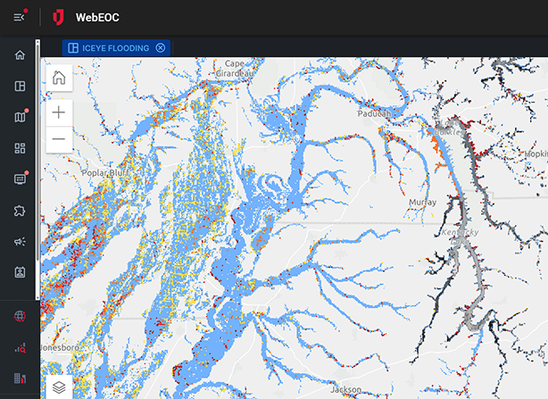
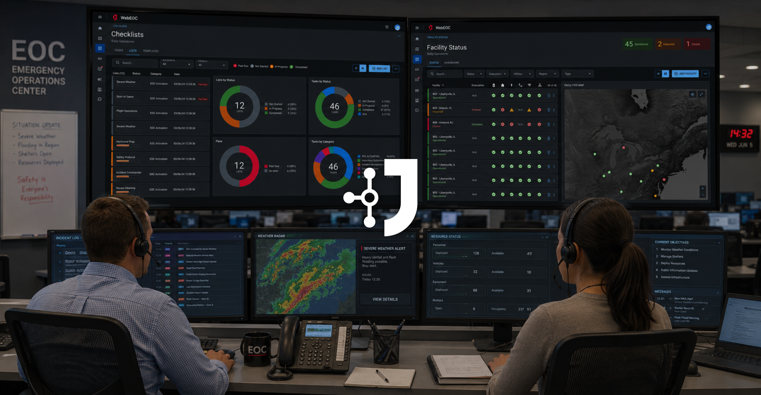
WebEOC Integration
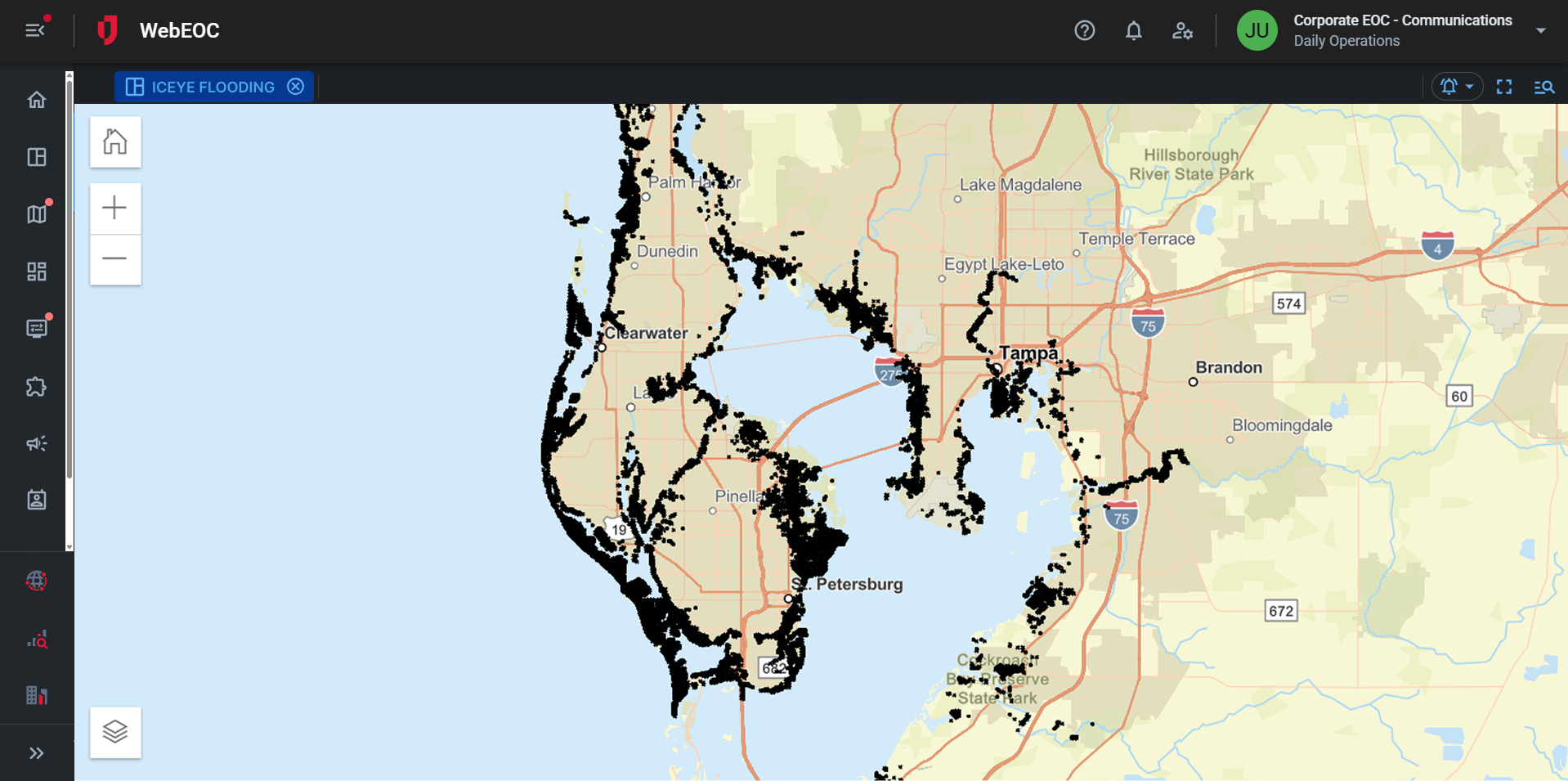
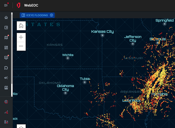
ICEYE data integrates directly into WebEOC and Crisis Track as map layers, combining satellite intelligence with operational data for a unified view.
Simple Implementation
The integration requires no new hardware or external systems. Agencies gain access through existing Juvare software with minimal setup.
Frequently Asked Questions
What does the ICEYE/WebEOC integration provide?
ICEYE embeds near real-time flood intelligence within WebEOC, helping agencies assess impacts and manage response activities in one system.
How fast is ICEYE’s flood data available?
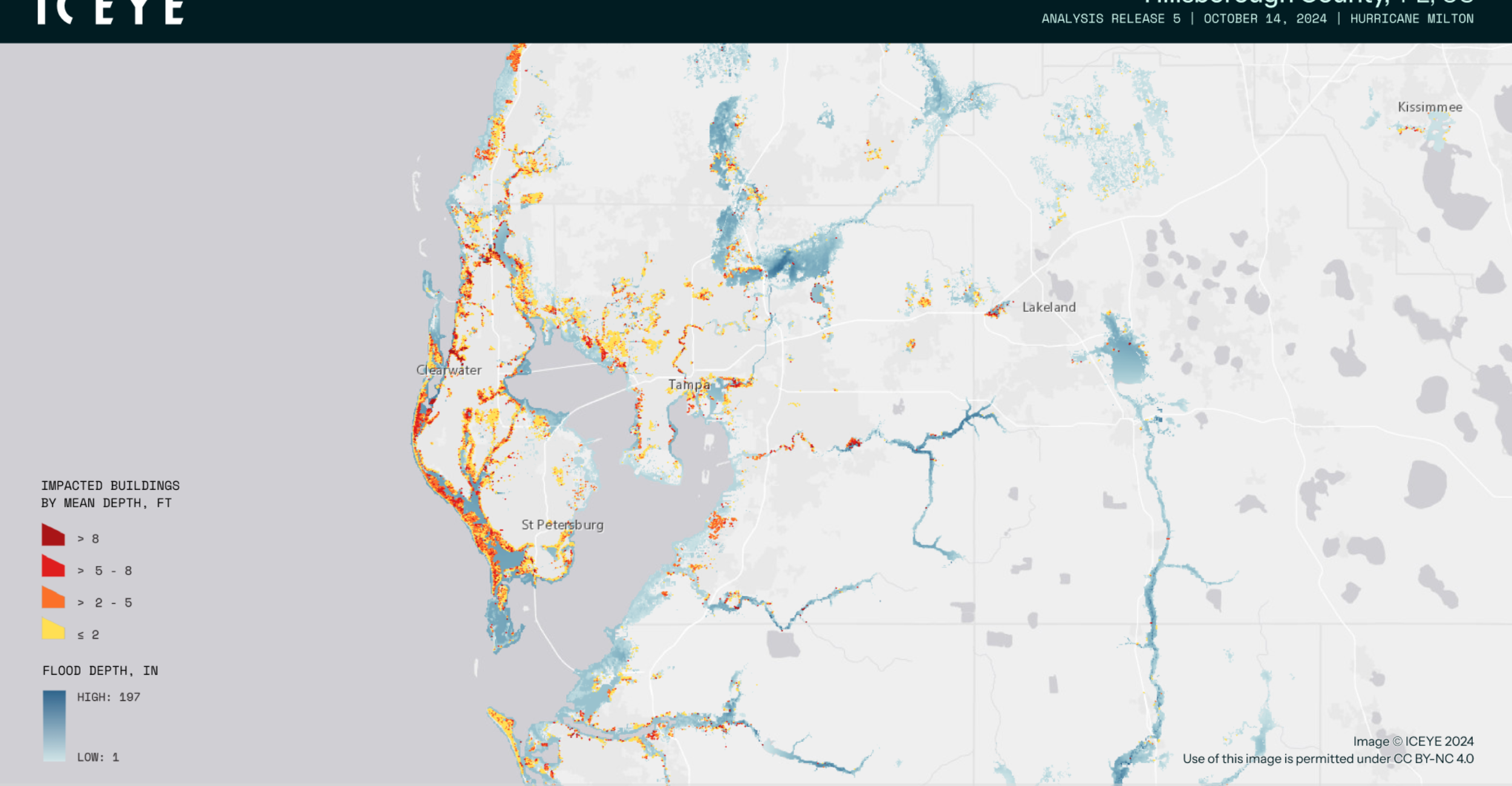
Flood maps are delivered within hours, even in cloudy or nighttime conditions, using SAR satellite technology.
How does real-time flood intelligence support agency decision-making?
With ICEYE’s flood intelligence helps agencies identify high-risk areas, deploy resources efficiently, and share verified updates within WebEOC. Centralizing flood data in WebEOC provides all teams with a shared operational picture, improving coordination and communication.
Who benefits most from real-time flood intelligence?
State, local, and federal agencies, along with critical infrastructure operators that need reliable flood intelligence benefit from ICEYE’s integration with WebEOC.
How reliable is ICEYE’s data?
ICEYE’s SAR satellites capture accurate data through clouds and darkness, validated with ground observations.
What does the integration process involve?
With this integration, ICEYE data flows directly into WebEOC, obviating the need for new tools or additional training.